


PROPERTY SEARCH

ARCHIVED - Unstable conditions return to much of Spain this week: rain, thunderstorms and changeable weather
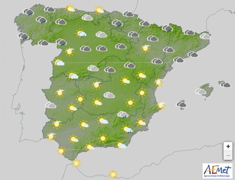
The Spanish Weather Agency (AEMET) forecasts a week of widespread showers in most parts of Spain though temperatures will remain at normal levels for the season, especially during the day, and could be lower than usual at night.
AEMET spokesman, Rubén del Campo, has said that unstable conditions are expected to continue, as clouds at medium and high levels will dominate at least the first three days of the week.
For Tuesday and Wednesday, the forecast is for showers and thunderstorms almost anywhere in the Peninsula, but they are most likely to occur in the northwestern, central-eastern and especially in the southeastern areas.
Maximum temperatures will mostly be within the usual range for the season. Minimum temperatures meanwhile will be lower than normal in the northeast of the peninsula and the Balearic Islands on Monday but will then tend to recover.
There will be gentle breezes from Monday to Wednesday.
With regards to the second half of the week, Del Campo said that instability will decrease on Thursday, which "will be a calm day", but an Atlantic front may arrive on Friday, which will cause moderate and widespread rain in most of the country.
Temperatures will rise across most of Spain from Thursday onwards.


Contact Spanish News Today: Editorial 966 260 896 /
Office 968 018 268