Cycling, walking, driving route 2, Cieza routes
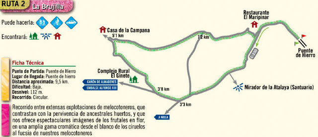
Route 2 La Brujilla

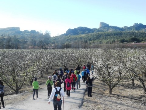
This route could be cycled, walked or driven through the Cieza municipality. The route passes through the peach orchards and agricultural cultivated areas which make Cieza such an attractive location to visit, particularly during the spring when the peach and plum trees are in bloom.

Departure and conclusion: Puente de Hierro (Iron bridge)
Distance: 9.5km
Difficulty: low
Climb: 112m
Type of route: circular
Click for map showing departure point, the Puente de la Isla.
This is right next to the watermill , the Molino de Teodoro, and there is parking in the carpark for the watermill. Click Molino de Teodoro
This route has particularly been designed to show off the beauty of La Floración during the spring when the peach orchards which surround the town are in blossom.
Print this page out:This page can be printed. Use the icons block at the top of this article, select the plus sign and click, print is amongst the options given. The route can be compared to the google map link given and is clearly visible on the actual google map.
Click for further information about visiting Cieza. This includes accommodation options, places to visit and general information about the area: Click Cieza section
Share your pictures with us via our what's on facebook if you do go and enjoy yourself!
Join the Murcia What's On and Where to Go group on Facebook to keep up to date with all the latest events taking place near you: https://www.facebook.com/groups/MurciaWhatsOnAndWhereToGo/


