article_detail
Date Published: 23/02/2023
ARCHIVED - From spring to winter in a few days: Spain weather forecast Feb 23-26
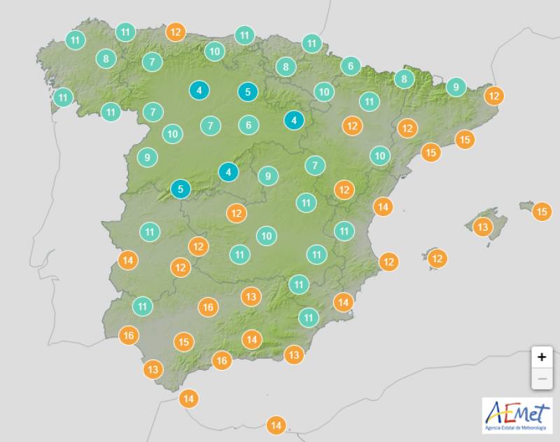
The thermometers will drop by 10ºC in parts of Spain with heavy frosts forecast for the entire country

Two weather anomalies combined midweek to return Spain to harsh weather conditions after a spring-like few days: a cold burst of polar air that began sweeping in on Wednesday February 22, together with a DANA (isolated depression at high levels), have mingled to plummet the temperatures by more than 10ºC in some areas.
The behaviour of a DANA is always “unpredictable,” according to Aemet’s Ruben del Campo, but the falling temperatures will certainly result in abundant snowfall, particularly in the north, from Thursday February 23.
As the front passes, the clouds will increase and there will be rainfall in the northern third of the country. The south of Spain will be mostly overcast with locally strong and persistent rains forecast in Galicia, Cantabria and around the Pyrenees, but these showers could also spread to parts of the Valencian Community and the Balearic Islands.
As the snow level dips to 600-800 metres, even in the south, several regions are under orange alert for snowstorms on Thursday.
The temperature won’t hit the Mediterranean coast quite as hard, and Murcia can still expect a balmy 21ºC.
The “uncertainty increases” on Friday February 24, according to del Campo, but he believes that most of the heavy rainfall will be confined to the north, while the Balearic Islands and the southwest could also experience some showers.
The snow levels are “still low”: just 500-800 metres in inland Spain and a little higher further east.
It’s on Friday that the country will really feel the thermal drop, as the mercury plummets to just 15ºC in Alicante and Murcia.
Widespread frosts are forecast throughout Spain, with the exception of western Andalusia.
Ten regions, including Madrid, remain on high alert for a significant cold snap and possible snowstorms.
The temperatures will gradually recover as we move into the weekend, but the early mornings will continue to be very cold, with significant frosts in large areas.
The low front should confine itself to northern Spain on Saturday February 25, creating rain and possible storms in Galicia, but heavy storms and occasional blustery weather have not been ruled out for the southwest of the country and the Balearic Islands, which will experience a largely cloudy day with some bright spells.
Westerly winds could feel strong along the Mediterranean coast and Andalucia has been issued with a yellow weather warning for adverse sea conditions.
Things will finally begin to stabilise on Sunday February 26 and although most of the country will dawn very overcast, this should clear throughout the day. Any rainfall will be generally weak, although the north should still prepare for a few stormy episodes.
Daytime temperatures will drop once more in northern Spain but take a welcome, if slight, upswing in the south, peaking at 20ºC in Alicante.
Frosts will again be widespread with the exception of central and western Andalucia, but no weather alerts have been issued for Sunday so far.
Join our Spain Weather Watch Facebook group for regular weather insghts
Image: Aemet
Loading
Sign up for the Spanish News Today Editors Roundup Weekly Bulletin and get an email with all the week’s news straight to your inbox
Special offer: Subscribe now for 25% off (36.95 euros for 48 Bulletins)
OR
you can sign up to our FREE weekly roundup!
Read some of our recent bulletins:
Discount Special Offer subscription:
36.95€ for 48 Editor’s Weekly News Roundup bulletins!
Please CLICK THE BUTTON to subscribe.
(List price 3 months 12 Bulletins)
Read more stories from around Spain:
Contact Spanish News Today: Editorial 966 260 896 /
Office 968 018 268


