


PROPERTY SEARCH


More storms arriving as rain worsens: Spain weather forecast October 30-November 2
The downpours are intensifying and thunderstorms will spread to most of Spain before the weekend
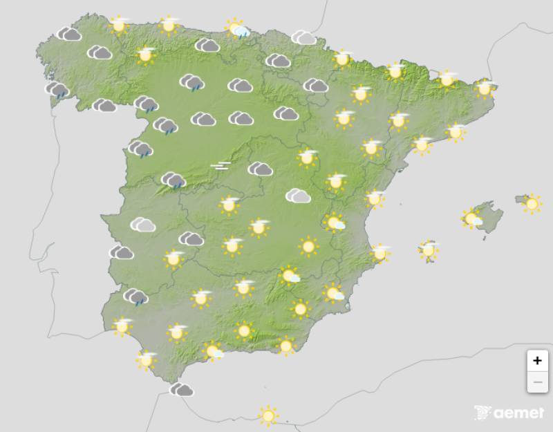
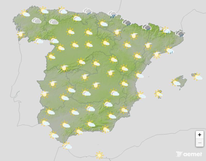
Weather outlook on Saturday morning, November 1
Wednesday's storm system delivered a serious blow across southwestern Spain. Rainfall totals exceeded 100mm in parts of Sevilla and surpassed 70mm in Huelva, where the authorities activated a red alert for the province. Streets were flooded, cars were swept away and the public transport ground to a halt.
The intensity and widespread nature of the rainfall caught many off guard, but there's little respite in sight. While the current storm system will gradually move away through the Mediterranean over the coming hours, new weather fronts are already queuing up to arrive through Galicia, bringing fresh rain over the weekend.
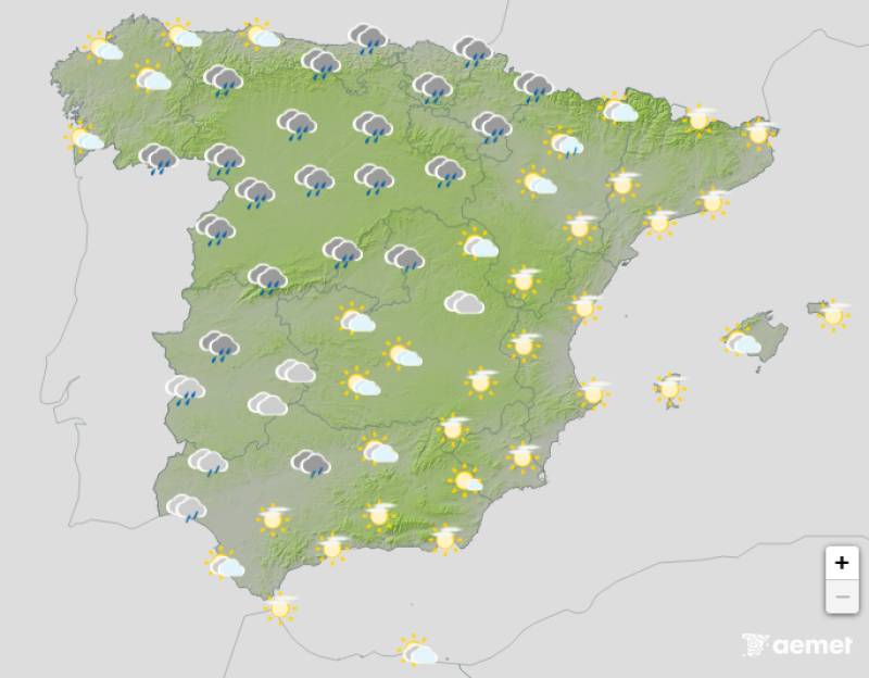
Thursday October 30
Today we'll see what's left of Wednesday's storm pushing out through the Mediterranean. The rain will steadily weaken as it moves, though some areas could still see heavy bursts. The State Meteorological Agency (Aemet) expects wet conditions to presist across the Valencian Community, the Region of Murcia, eastern Andalucia and particularly the Balearic Islands.
An orange alert remains in force for northern Mallorca and Menorca, where up to 40mm could fall in just one hour accompanied by thunderstorms. Yellow warnings cover the southern Valencia coast, northern Alicante, Ibiza, Formentera and much of Mallorca, with accumulations potentially exceeding 20mm per hour.
By Thursday afternoon, a fresh weather front will begin moving in through Galicia. Western parts of this northern region should brace for heavy rain, with totals potentially surpassing 40mm over 12 hours. Strong southerly winds will accompany the rain, with gusts reaching over 80km/h in exposed areas.
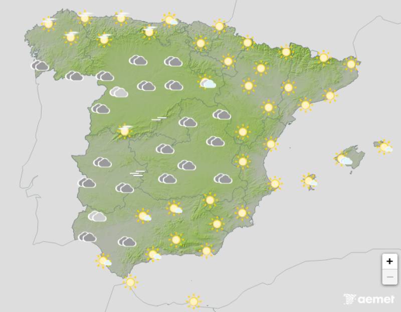
Friday October 31
On Friday, this weather front spread across Galicia, Asturias, Cantabria and Castilla y León. Northern Extremadura, the Basque Country, La Rioja and Navarra will also see rain moving in.
The northwestern corner of Castilla y León, Galicia and the Cantabrian coast face the heaviest and most persistent rainfall as the front crawls forward at a snail's pace. This slow movement means rainfall totals could really stack up in these areas.
Saturday November 1
The weather front will barely budge on Saturday, grinding to an almost complete standstill. Galicia should see rainfall ease off somewhat as the wet weather shifts across the Cantabrian coast, Castilla y León, La Rioja, Navarra and Extremadura.
Come Saturday evening, the rain will finally reach central Spain. Madrid and Castilla-La Mancha will turn wet, along with Aragon, inland Catalonia, the Valencian Community and western and inland parts of Andalucia.
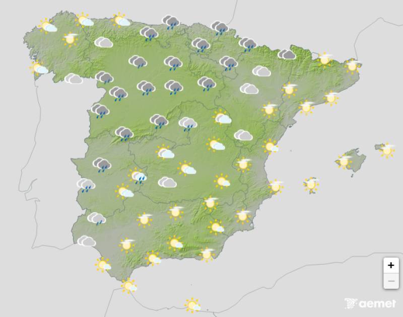
Sunday November 2
The weather front will lose its punch during the early hours and morning of Sunday. Eastern Spain might see some light, scattered showers affecting parts of Catalonia, the Valencian Community, eastern Castilla-La Mancha, Andalucia and the Balearic Islands.
For most of the country, Sunday afternoon looks fairly settled. However, an extremely weak front will clip the far north, bringing light rain to Galicia, Asturias, Cantabria, the Basque Country and the Pyrenees.
Join our Spain Weather Watch Facebook group for all the latest weather and climate change news
Images: Aemet


Sign up for the Spanish News Today Editors Roundup Weekly Bulletin and get an email with all the week’s news straight to your inbox
Special offer: Subscribe now for 25% off (36.95 euros for 48 Bulletins)
OR
you can sign up to our FREE weekly roundup!
Read some of our recent bulletins:
Discount Special Offer subscription:
36.95€ for 48 Editor’s Weekly News Roundup bulletins!
Please CLICK THE BUTTON to subscribe.
(List price 3 months 12 Bulletins)
Read more stories from around Spain:


Contact Spanish News Today: Editorial 966 260 896 /
Office 968 018 268