


PROPERTY SEARCH

Spain bakes in 43 degree heatwave: Weather forecast August 11-14
The worst of the heat will hit Extremadura, Andalucía and Aragon, where temperatures could reach 42°C or 43°C in the shade
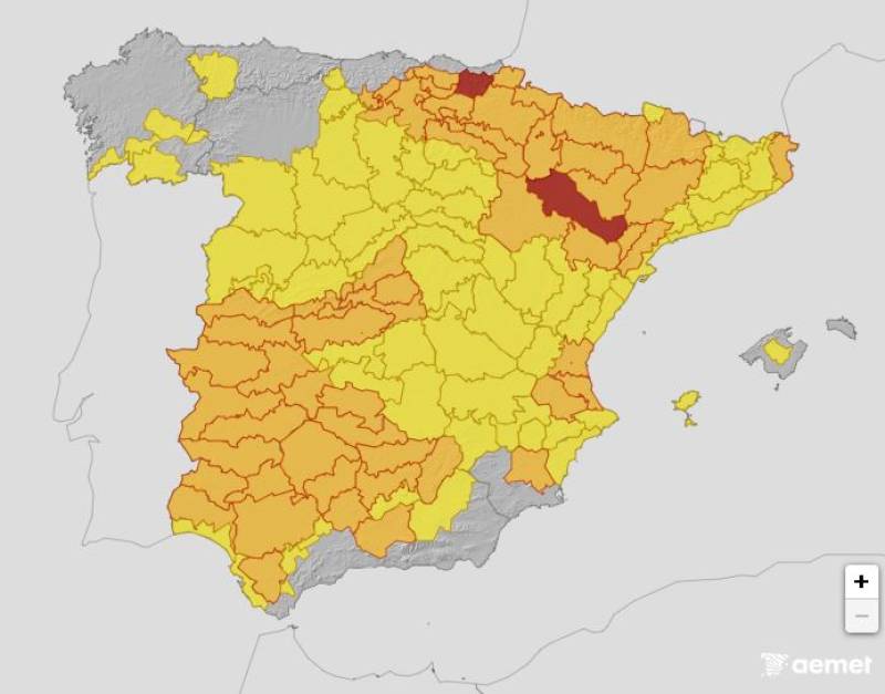
Heat alerts on Monday August 11
The scorching heatwave gripping Spain is showing no signs of easing, with the State Meteorological Agency (Aemet) warning it will last until at least Wednesday.
The hottest spell is set to hit on Monday August 11, when the mercury will soar past 40°C in the shade in some of the country’s main river valleys, including the Tagus, Guadiana and Guadalquivir. Parts of the Ebro basin, the Lleida depression, the Segura valley, southern Valencia and even the island of Gran Canaria are also bracing for the searing conditions.
Aemet predicts that much of the country will remain under an orange weather warning in the coming hours, with the Canary Islands on red alert for extreme heat. The most intense conditions are expected in Extremadura, Andalucía and Aragón, where the shade temperature could reach an eye-watering 42 or 43°C.
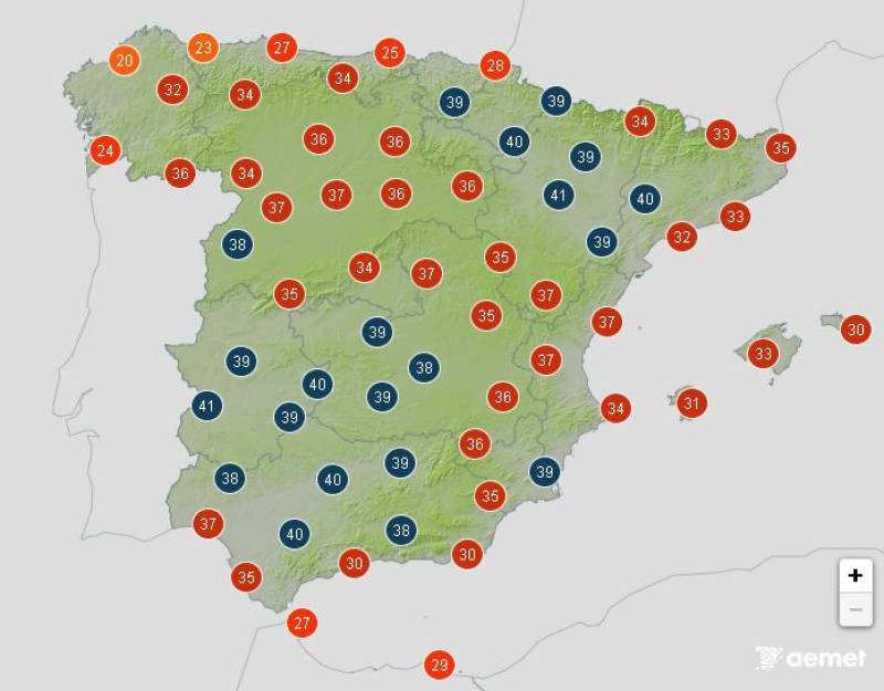
Temperatures forecast on Monday afternoon
Aemet says maximum temperatures will continue to rise on Monday across the Ebro basin, the southern and eastern parts of Spain and the eastern Cantabrian coast. The north-western corner, particularly Galicia, will get some relief as the heat begins to ease slightly there.
Across most of the interior, however, the thermometer will stay firmly in the 36-38°C range, climbing to 39-40°C in some eastern areas.
“This day is expected to be the hottest of this episode,” Aemet warned.
In the Canary Islands, the heatwave reached its peak over the weekend, with nights offering little respite as temperatures stayed above 26-28°C. From Monday, the islands should start to cool down, though Gran Canaria’s inland valleys could still top 40°C, with haze adding to the discomfort.
The hot, dry air mass lingering over Spain will hold its grip until midweek. Aemet expects temperatures to start dropping on Tuesday August 12, but mainly in the far north and the north-east.
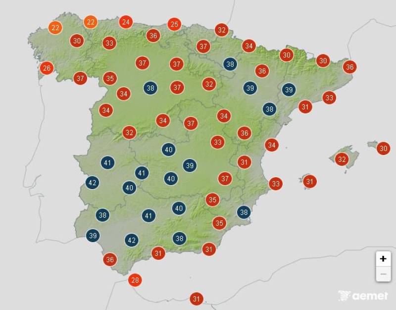
Temperatures forecast on Tuesday afternoon
Elsewhere, highs will still hover around 36-38°C and 39-40°C in the Miño and Ebro valleys, parts of Valencia, the Segura valley and the south-west. In the Tagus, Guadiana and Guadalquivir valleys, the mercury could again tip over 42°C.
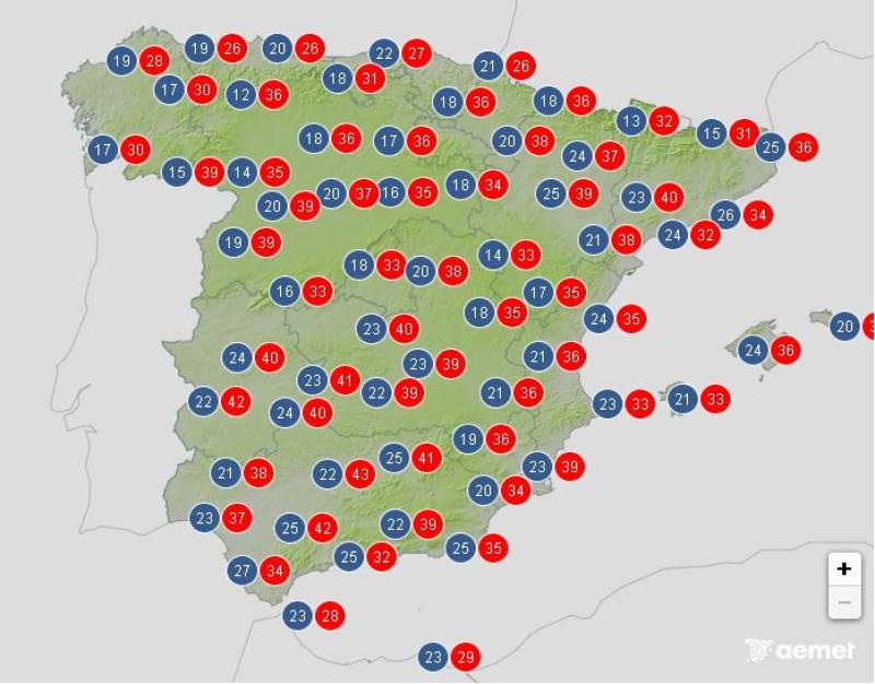
By midweek, thunderstorms are forecast in the interior and north-east, bringing strong gusts of wind and even hail. These could offer brief relief in the Pyrenees, southern Aragón, the eastern edges of Castilla y León and Castilla-La Mancha and inland Valencia, hinting at the long-awaited end to this punishing heatwave on Wednesday August 13.

Average temperatures expected on Wednesday
All of the weather alerts have been lifted for Thursday August 14 and it’s set to become quite overcast during the afternoon in the east of the country, where showers and even the odd thunderstorm are expected.
Average temperatures expected on Thursday
Daytime temperatures should drop in most places, but the mercury will still tip 35°C in the south.
Join our Spain Weather Watch Facebook group for all the latest weather and climate change updates
Images: Aemet


Sign up for the Spanish News Today Editors Roundup Weekly Bulletin and get an email with all the week’s news straight to your inbox
Special offer: Subscribe now for 25% off (36.95 euros for 48 Bulletins)
OR
you can sign up to our FREE weekly roundup!
Read some of our recent bulletins:
Discount Special Offer subscription:
36.95€ for 48 Editor’s Weekly News Roundup bulletins!
Please CLICK THE BUTTON to subscribe.
(List price 3 months 12 Bulletins)
Read more stories from around Spain:


Contact Spanish News Today: Editorial 966 260 896 /
Office 968 018 268