article_detail
Date Published: 08/01/2024
Spain prepares for the first DANA of 2024: weather forecast Jan 8-11
Most regions of Spain are on alert for driving rain and snow in the coming days
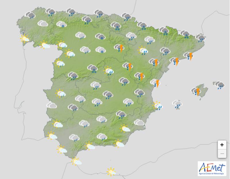
Weather outlook on Wednesday January 10
The wintery episode which began over the weekend is set to take hold for at least another couple of days and will likely intensify with the entry of a DANA storm (Isolated Depression at High Levels) on Tuesday.
This front will result in widespread rainfall throughout Spain and the Balearic Islands until at least Friday and snow at much lower altitudes.
Monday January 8
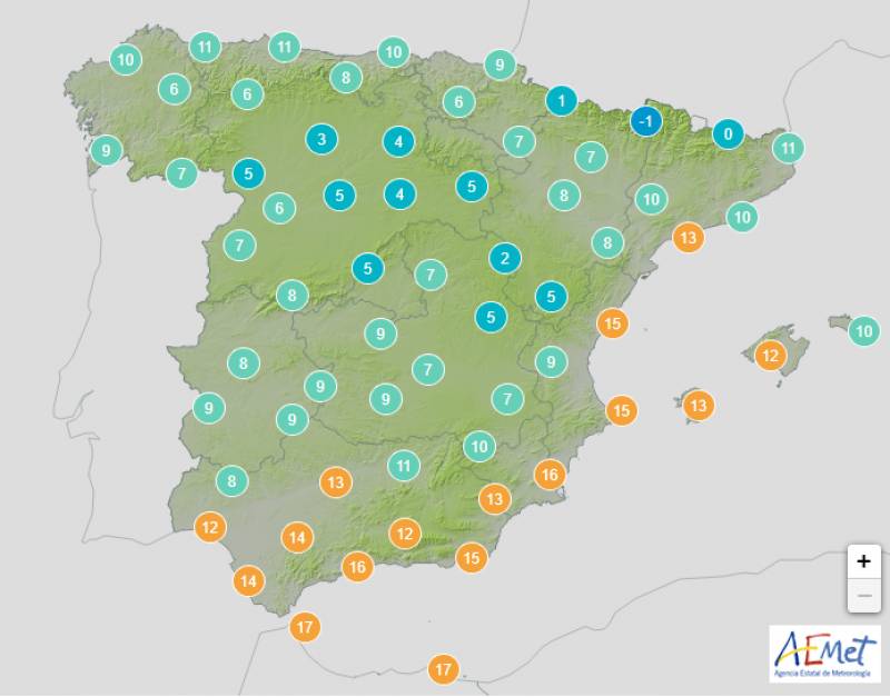
A northwest Atlantic front that dictated the weather over Three Kings weekend will be replaced on Monday by another chilly flow from the west, resulting in mostly cloudy skies that will darken more as the day goes on.
This, coupled with a Mediterranean storm near the Balearics will bring a chance of showers across the board, although the rain will be heaviest in the southwest, particularly in Huelva and Extremadura.
Significant snowfall in forecast around the Pyrenees and the rest of the northwest at between 400 and 800 metres.
However, both day and nighttime temperatures will creep up in the Canary Islands and the south of the country in general.
Yellow weather alert for low temperatures and/or strong winds: Castilla y Leon, Madrid, Valencian Community.
Orange weather alert for strong winds: Balearic Islands, Catalonia.
Tuesday January 9
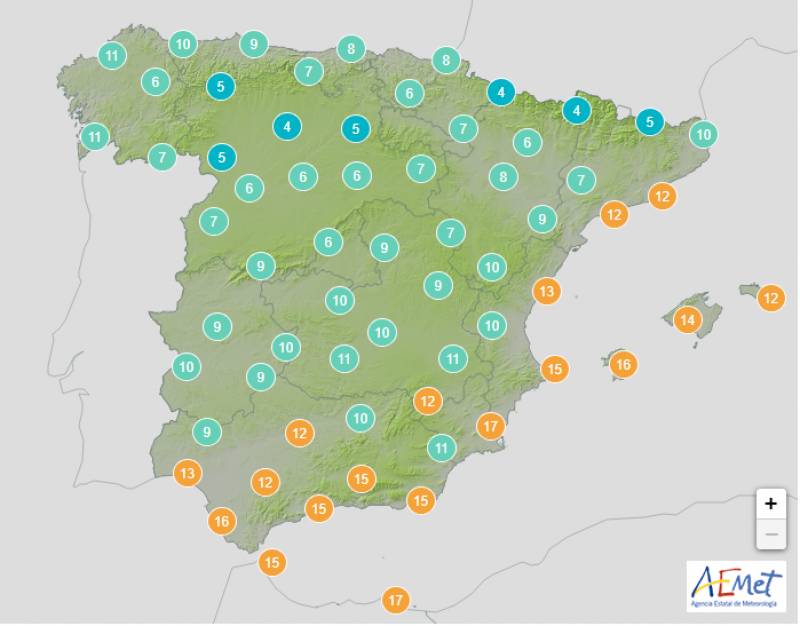
A DANA will approach Spain to the north of the country on Tuesday at the same time as an Atlantic low to the southwest. While it’s still uncertain how these two weather patterns will interact, at the moment the State Meteorological Agency (AEMET) expects predominately overcast skies and very heavy rain in the northwest and the entire southern half of the country.
More intense rain is expected in the southwest of Andalucia accompanied by occasional storms.
The mercury will drop in the Mediterranean although the cloud cover means the night should be a little milder than previous days.
Yellow weather alert for strong winds: Aragon, Balearic Islands, Catalonia, Navarra.
Wednesday January 10
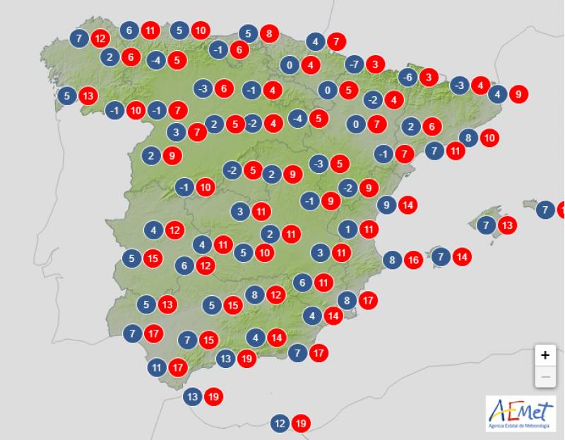
The ongoing DANA and Mediterranean low front will create mostly cloudy or overcast skies on Wednesday with rainfall predicted in almost the entire country. The forecast is still rather uncertain, but it seems likely that the showers will be weakest and more scattered in the west of Spain, while the northeast bears the brunt.
Daytime temperatures should climb in the extreme southwest with few changes elsewhere.
Yellow weather alert for snow: Catalonia, Navarra.
Orange weather alert for snow: Aragon.
Thursday January 11
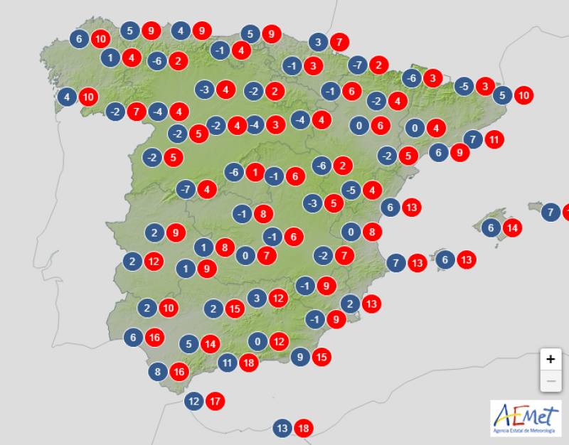
On Thursday, it seems likely that the interaction between the DANA in the north of Spain and an Atlantic front heading east will give rise to a developing Mediterranean cyclone, whose path and strength remain very uncertain. With this, the north of Spain will be predominantly overcast although the cloud cover and rain should subside later in the day in the rest of the country.
Daytime temperatures will take a dip in the southeast and the evening will grow cooler in southern Spain and the Balearic Islands.
Join our Spain Weather Watch Facebook group for regular updates
Images: Aemet
Loading
Sign up for the Spanish News Today Editors Roundup Weekly Bulletin and get an email with all the week’s news straight to your inbox
Special offer: Subscribe now for 25% off (36.95 euros for 48 Bulletins)
OR
you can sign up to our FREE weekly roundup!
Read some of our recent bulletins:
Discount Special Offer subscription:
36.95€ for 48 Editor’s Weekly News Roundup bulletins!
Please CLICK THE BUTTON to subscribe.
(List price 3 months 12 Bulletins)
Read more stories from around Spain:
Contact Spanish News Today: Editorial 966 260 896 /
Office 968 018 268


