


PROPERTY SEARCH


Storms continue in southern Spain this week: Weather forecast October 13-16
Heavy downpours will bookend the coming week along the Mediterranean coast of Spain
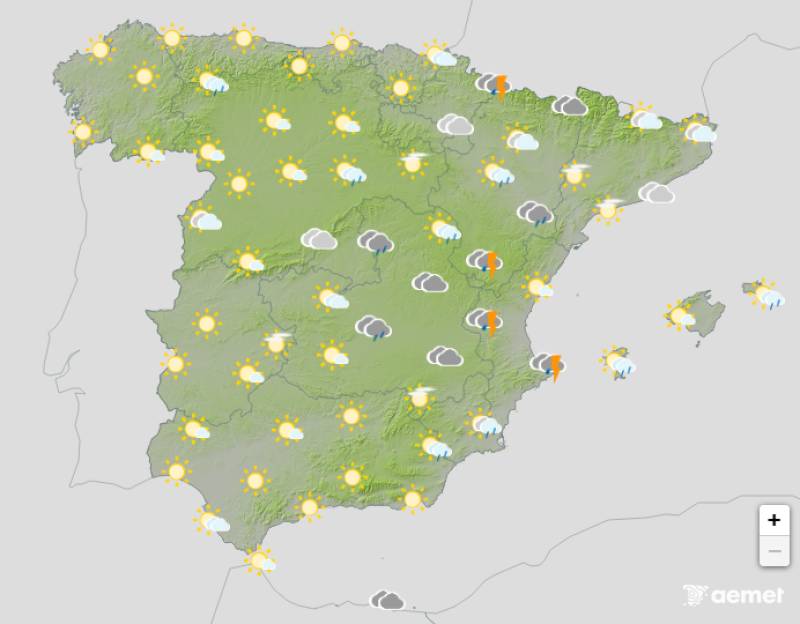
Weather outlook on Monday afternoon
Dana Alice, which caused widespread destruction in Murcia and Alicante over the weekend, has finally moved on but that doesn’t mean the storm has passed. Much of the Mediterranean coast and eastern Spain in general can expect a wet and windy start to the week, followed by a drier spell before the rain returns on Friday.
On Monday October 13, orange weather warnings remain in place from northern Alicante, running through the Valencian Community, Ibiza and Formentera, and right up as far as northern Catalonia. In these areas, rainfall is expected to reach 40 to 50 litres in one hour and up to 80 to 100 litres in 12 hours, although the State Meteorological Agency (Aemet) has warned that the downpours could be even more intense in places.
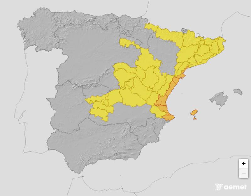
Weather alerts in effect on Monday
The instability in the Mediterranean should ease by midweek, but rather than disappear entirely, the stormy weather will instead arrive from the Atlantic. A new front will bring rain and much cooler temperatures next weekend, entering Galicia on Friday October 17 and spreading to other areas, especially in the northwest of the country.
But during the first couple of days of this week, the heaviest rain will again be concentrated in the eastern half of Spain and the Balearic Islands, where even more flooding is expected.
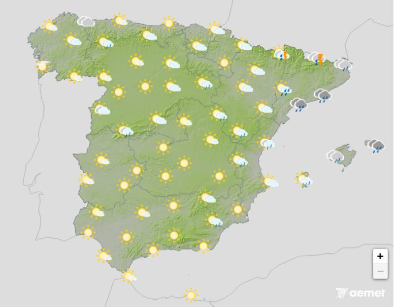
Weather outlook on Tuesday afternoon
An orange warning remains in effect in the Balearics on Tuesday October 14, while the Valencian Community, Castilla-La Mancha and Catalonia have been downgraded to yellow.
All of the alerts have been lifted for Wednesday October 15, but the day will remain overcast and showery with a chance of isolated thunderstorms inland and along the eastern coasts.
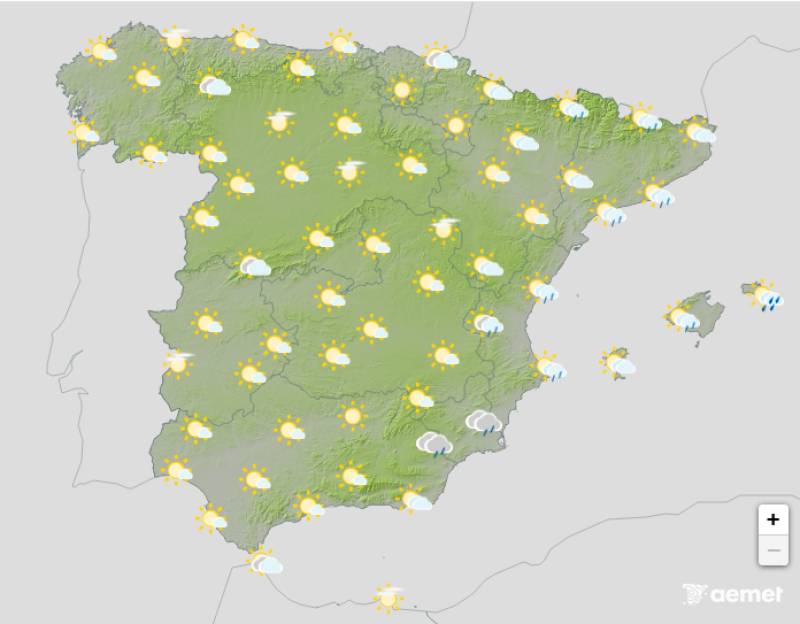
Weather outlook on Wednesday afternoon
Cloudy skies with showers and some thunderstorms are likely from early hours of Thursday morning, October 16, around the Gulf of Valencia and the eastern Balearic Islands. Medium and high cloud cover will also increase in the southwest, leaving cloudy or overcast skies in the southern half of the country.

Weather outlook on Thursday afternoon
Although temperatures have gradually returned to the levels we should expect for this time of year, the mercury is still well above average in many provinces, especially in the west of the country.
On Monday, daytime temperatures will be 3ºC to 5ºC higher than normal for October 13 in many capital cities, with maximums of 30ºC or more forecast in areas of western Andalucia and southern Extremadura.
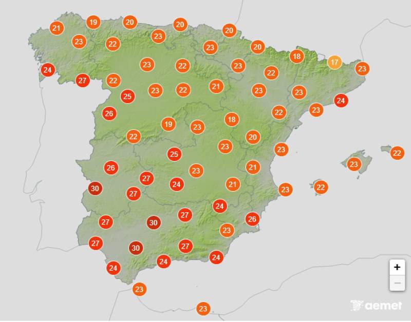
Average temperatures expected on Tuesday
Tuesday October 14 will follow a similar pattern, with maximum temperatures hovering between 25ºC and 30ºC or more in several capital cities. It will remain cool in the eastern Iberian Peninsula and the Balearic Islands, especially due to abundant cloud cover, heavy rain and wind. The Canary Islands will be one of the few regions where its capitals will experience tropical nights, although southern Andalucia could also experience balmy evenings.
>>> Get more weather insights about Murcia here or join our Facebook groups: Murcia Weather Watch, Spain Weather Watch and Alicante Weather Watch<<<
Images: Aemet


Sign up for the Spanish News Today Editors Roundup Weekly Bulletin and get an email with all the week’s news straight to your inbox
Special offer: Subscribe now for 25% off (36.95 euros for 48 Bulletins)
OR
you can sign up to our FREE weekly roundup!
Read some of our recent bulletins:
Discount Special Offer subscription:
36.95€ for 48 Editor’s Weekly News Roundup bulletins!
Please CLICK THE BUTTON to subscribe.
(List price 3 months 12 Bulletins)
Read more stories from around Spain:


Contact Spanish News Today: Editorial 966 260 896 /
Office 968 018 268