


PROPERTY SEARCH

Stormy intervals followed by scorching temperatures: Spain weather forecast May 6-9
This week in Spain will start with showers and strong storms in some areas, and will end with summer temperatures
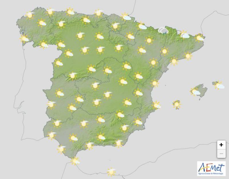
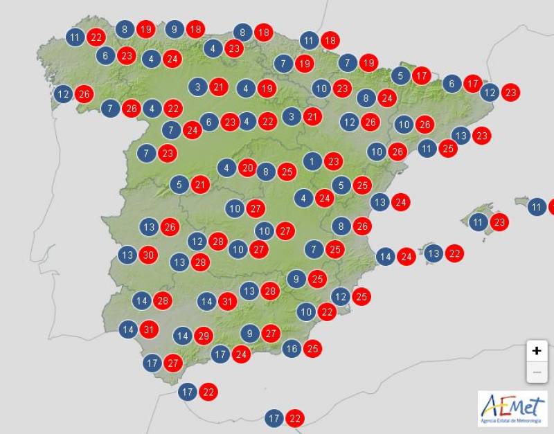
Weather outlook on Wednesday May 8
The weather for the coming week in Spain will be determined by a ridge retreating towards the east of the country, leading to much higher temperatures than usual for early May. However, this will be followed by another front which will bring daytime showers and even some thunderstorms as it moves across Spain.
As the week goes on, the pattern will reverse, with the ridge bringing higher temperatures to western and inland Spain while a low pressure system (DANA) could see heavy rain in the northeast and the Balearic Islands.
To start off the week, on Monday May 6 the combination of the advancing trough and humidity will lead to heavy showers and thunderstorms in parts of the northeast, including Catalonia, the Iberian System and the Pyrenees, as well as inland Murcia, northern Alicante and the eastern foothills of Sierra Morena.
These showers have the potential to be locally strong and stormy in the northeast and Catalan Pyrenees, with the State Meteorological Agency (AEMET) issuing warnings for accumulations of up to 20 litres per square metre within an hour, along with a possibility of hail.
Moving into Tuesday May 7, the formation of a subtropical ridge will decrease the likelihood of showers in most areas, though overcast skies and light rain are still possible in the Cantabrian region and the Pyrenees. Showers and thunderstorms are expected in the eastern Pyrenees, northeastern Catalonia and the Balearic Islands, but the rain is very unlikely to spread further.
The threat of showers will disappear by Wednesday May 8 and the sun will return to all of Spain and the archipelagos, although mountainous areas of Tenerife could still experience some isolated thunderstorms.
By Thursday May 9, the anticyclonic, stable weather will really take hold throughout the country, and only light, high clouds will blot the horizon. Weak frosts will persist in the Pyrenees but the mercury will continue to climb both during the day and at night everywhere else.
Summery temperatures for most of the week
Overall, temperatures for the week will remain warmer than normal across Spain, with the exception of the Balearic Islands and Catalonia. The mercury should waver between 1 and 3°C above average in most parts.
Initially, the first half of the week will feature relatively mild temperatures in the north, with maximums staying below 18-19°C. However, the Mediterranean region will experience significantly hotter conditions, reaching 30°C or higher in the south of the Valencian Community, Murcia, Almeria and the Balearic islands on Monday.
By midweek, temperatures will start to climb even further, surpassing 30°C in the Guadalquivir Valley, southern Gran Canaria and Fuerteventura on Wednesday, and spreading to include most of Spain by Thursday, when temperatures are forecast to reach 25°C or higher, even in the coastal areas of Galicia.
By the end of the week, temperatures are predicted to soar past 30-32°C in many locations, particularly in the interior, the Guadalquivir and Guadiana valleys, the eastern portion of the Canary Islands, the Ebro valley and the eastern half of the country.
Join our Spain Weather Watch Facebook group for regular updates
Images: Aemet


Sign up for the Spanish News Today Editors Roundup Weekly Bulletin and get an email with all the week’s news straight to your inbox
Special offer: Subscribe now for 25% off (36.95 euros for 48 Bulletins)
OR
you can sign up to our FREE weekly roundup!
Read some of our recent bulletins:
Discount Special Offer subscription:
36.95€ for 48 Editor’s Weekly News Roundup bulletins!
Please CLICK THE BUTTON to subscribe.
(List price 3 months 12 Bulletins)
Read more stories from around Spain:


Contact Spanish News Today: Editorial 966 260 896 /
Office 968 018 268