


PROPERTY SEARCH

ARCHIVED - Sunny start to Easter gives way to rain and falling temperatures: Spain weather Apr 3-6
Holy Week will begin warm and bright across Spain but the rainy weather will return before the weekend
As storm Mathis passes through northern Europe, it has brought a mass of cold and humid air that has halted the scorching temperatures in Spain in their tracks. After a sweltering few days across the country, the thermometers plummeted on Sunday April 2, dropping to around 5ºC below normal in most places.
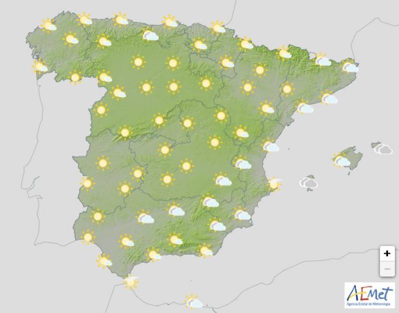
Holy Monday, April 3, will begin with hardly any rainfall, except in the far north of Spain and the Balearic Islands. However, cold overnight winds will create a frosty start in mountainous areas with cities like Avila dropping below zero.
In stark contrast is southern Spain, where the mercury will tip 28ºC in Seville and the Guadalquivir Valley.
Monday will be generally bright with some medium and high clouds in the west.
According to the State Meteorological Agency (Aemet), the stable weather will continue into Tuesday April 4 and Wednesday April 5 in almost the entire country, although night frosts will continue to hit the north and central Spain. Temperatures will hover around the 18-20ºC mark, but again could easily exceed 30ºC in the extreme south.
Cloudy skies will predominate in the Canary Islands, with a chance of light rain on Tuesday, and it will become increasingly overcast along the Mediterranean coast. Southern Andalucía and parts of Murcia will likely have a damp start to the day on Wednesday, although the skies will clear in the south as we move towards the afternoon.
The instability will increase on Thursday April 6 as the high pressures begin to retreat to northern Europe, giving way to Atlantic lows that will likely result in plenty of showers in the southwest of Spain over the weekend.
Daytime temperatures will continue to rise in most of the country, hitting the high teens or low 20s, and Thursday night will be considerably warmer in the north, weakening the frosts and restricting them to high mountainous areas.
While the forecasts for weekend could still change, the experts at Meteored predict the arrival of “a trough or a storm in the Atlantic, which could head towards the Peninsula. This change will likely mark the end of Easter week, “causing an increase in cloudiness and some precipitation.”
"It seems likely that during the second half of next week a blocking anticyclone will set in around Iceland or Scandinavia, which would open the door for a change in weather in Spain ," explains Samuel Biener, Meteored meteorologist. "If the high pressures strengthen in the area of Iceland or Scandinavia, the storms and the detachments could go towards more southern latitudes."
Join our Spain Weather Watch Facebook group for regular weather updates
Image: Aemet


Sign up for the Spanish News Today Editors Roundup Weekly Bulletin and get an email with all the week’s news straight to your inbox
Special offer: Subscribe now for 25% off (36.95 euros for 48 Bulletins)
OR
you can sign up to our FREE weekly roundup!
Read some of our recent bulletins:
Discount Special Offer subscription:
36.95€ for 48 Editor’s Weekly News Roundup bulletins!
Please CLICK THE BUTTON to subscribe.
(List price 3 months 12 Bulletins)
Read more stories from around Spain:


Contact Spanish News Today: Editorial 966 260 896 /
Office 968 018 268