Walking in Águilas: the headland of Cabo Cope
The PR-MU 104 route offers spectacular views from the lower slopes of Cabo Cope
Cabo Cope is the imposing headland which juts out into the Mediterranean next to the village of Calabardina, in the municipality of Águilas, reaching a height of 242 metres and dominating the landscape.
At the same time it is part of the natural park of Cabo Cope and Puntas de Calnegre, declared a Site of Community Interest on account of its tectonic and geomorphological complexity, its singular vegetation, the presence of endangered species and the existence of sites of archaeological and historical interest.

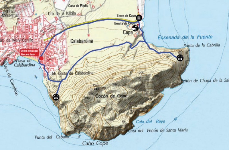
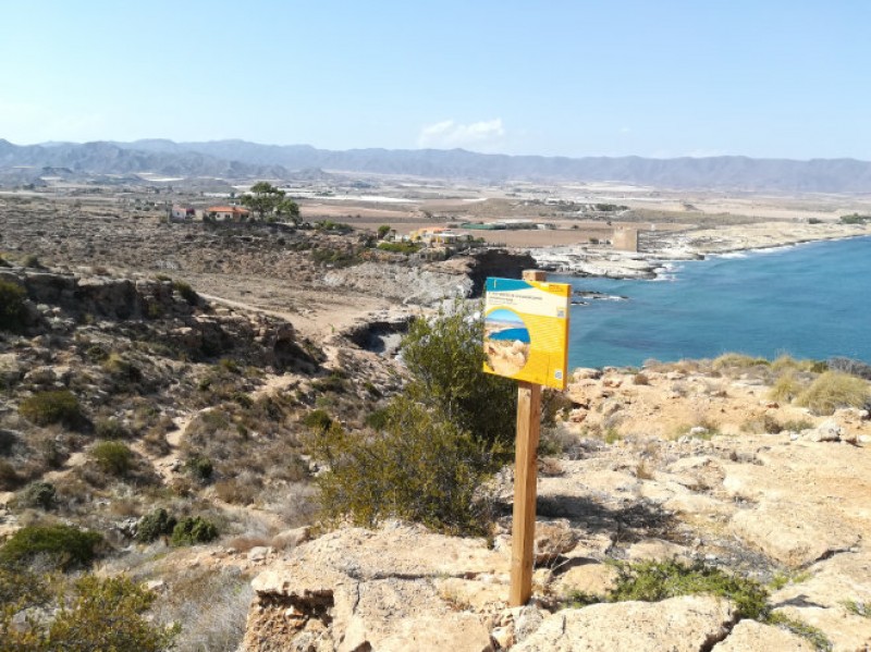
The route of the PR-MU 104 path allows walkers to visit the headland without encroaching on the areas of special natural interest which are home to endangered species, and basically runs along the inland lower slopes from one side of the mountain to the other. Two proposed additional detours are also recommended, one on the eastern side of the headland, rising on a stony path to the viewing point known as “Cerro de la Cabrica” (hill of the small goat), and the other on the western side, much shorter and easier, taking visitors up to another viewing point known as the “Cocón de Cope”.
Also along the route are the Torre de Cope, a watchtower which was built in the 16th century to provide warning when Berber raiders approached the Murcia coastline from north Africa, and the remains of the Ermita de Cope, a tiny chapel dating from the same period.
PR-MU 104
Length: 4 km (6 km with detours)
Ascent: 46 metres (154 with detours)
Estimated duration: 1½ hours (2½ hours with detours)
Start and finish point: La Torre de Cope
Click for the Wikiloc route map, or for more information about the municipality of Águilas visit Águilas Today.


