


PROPERTY SEARCH

Winter makes one last push: Spain weather forecast March 12-15
A new DANA could form over the weekend, bringing heavy rain, snow on the mountains and frost across much of Spain

Average temperatures exected on Sunday
Spain is getting a brief breather after this week's DANA, with Thursday shaping up to be a settled and relatively warm day across most of the country. It won't last long though, as a new weather front moving in from the northwest on Friday will set the scene for a much more disruptive and significantly colder weekend.
Thursday March 12
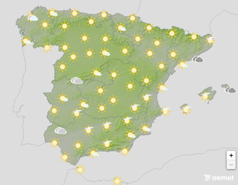
The DANA that caused disruption earlier in the week has moved away over Africa, and Thursday will be a much more settled day across Spain as a result. There will be some cloud building through the day and the odd very light shower is possible in mountainous areas of the southeast, but nothing significant.
Temperatures will be on the rise, with maximums exceeding 15°C across the country and reaching around 20°C in parts of Extremadura, the Guadalquivir Valley and the Ebro Valley. Badajoz and Huelva could see highs of around 21°C, with the biggest temperature gains in the north, where some mountainous areas including the Cantabrian Mountains and the Navarrese Pyrenees could be up by more than 4°C.
Friday March 13
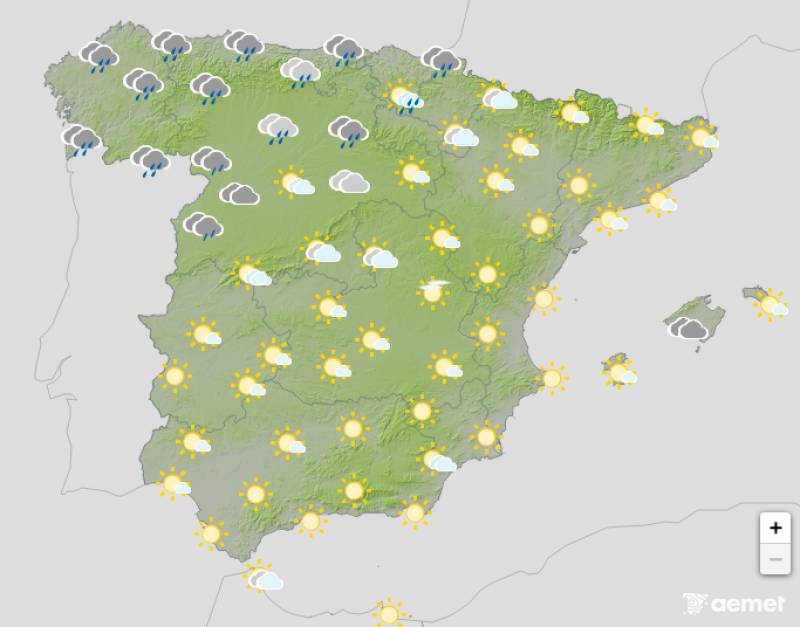
Friday will start reasonably settled across most of Spain, but a new weather front will arrive from the northwest during the morning, bringing rain to Galicia and Asturias first. As the day progresses, that rain will spread into Cantabria, the Basque Country and parts of Castilla y León.
Temperatures will remain above 15°C across most of the country and could still approach 20°C in the southern half, but the northwest will start to feel the chill, with Galicia, León, Salamanca and Zamora seeing noticeable drops as the cold air begins to push in.
Saturday March 14
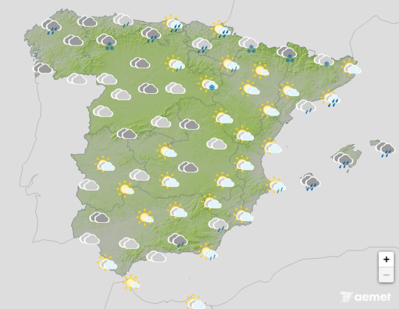
Saturday is where things turn significantly worse. The weather front will push further inland overnight and into the morning, bringing heavy rainfall to parts of the Pyrenees, the Iberian System and the Central System. Snow is expected above around 1,000 to 1,200 metres, with several centimetres possible on the higher ground.
By mid-morning, the front will reach the Mediterranean coast, where rainfall will intensify across Catalonia and the Balearic Islands before spreading to Valencia and Murcia during the afternoon. A trough accompanying the front could develop into a new DANA over the course of the day.
Temperatures will drop sharply, falling by around 5 to 6°C nationwide. Much of the Spain will see maximums back below 15°C, with parts of Castilla y León dropping below 10°C. Frost will return to much of the northern half of the country overnight.
Sunday March 15
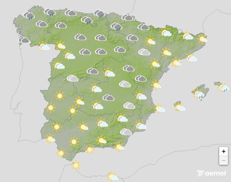
The new DANA is expected to move quickly southward throughout Sunday, which should bring some relief as the day goes on. Heavy rain will continue over the Balearic Islands into the early hours, but showers and storms should ease across most of the country by the afternoon.
The north will remain unsettled, with the northerly flow continuing to bring plenty of rain. Frost will spread further, affecting a larger part of the country than Saturday, so overnight temperatures will be something to keep an eye on across inland areas in particular.
For more weather news go to our Weather & Climate page or follow the Spain Weather Watch Facebook group for regular updates
Images: Aemet
Sign up for the Spanish News Today Editors Roundup Weekly Bulletin and get an email with all the week’s news straight to your inbox
Special offer: Subscribe now for 25% off (36.95 euros for 48 Bulletins)
OR
you can sign up to our FREE weekly roundup!
Read some of our recent bulletins:
Discount Special Offer subscription:
36.95€ for 48 Editor’s Weekly News Roundup bulletins!
Please CLICK THE BUTTON to subscribe.
(List price 3 months 12 Bulletins)
Read more stories from around Spain:


Contact Spanish News Today: Editorial 966 260 896 /
Office 968 018 268