article_detail
Date Published: 15/01/2024
Temperatures remain high but storms are on the way: Spain weather forecast Jan 15-18
The rain will become almost widespread across Spain by the end of the week as three different storms approach

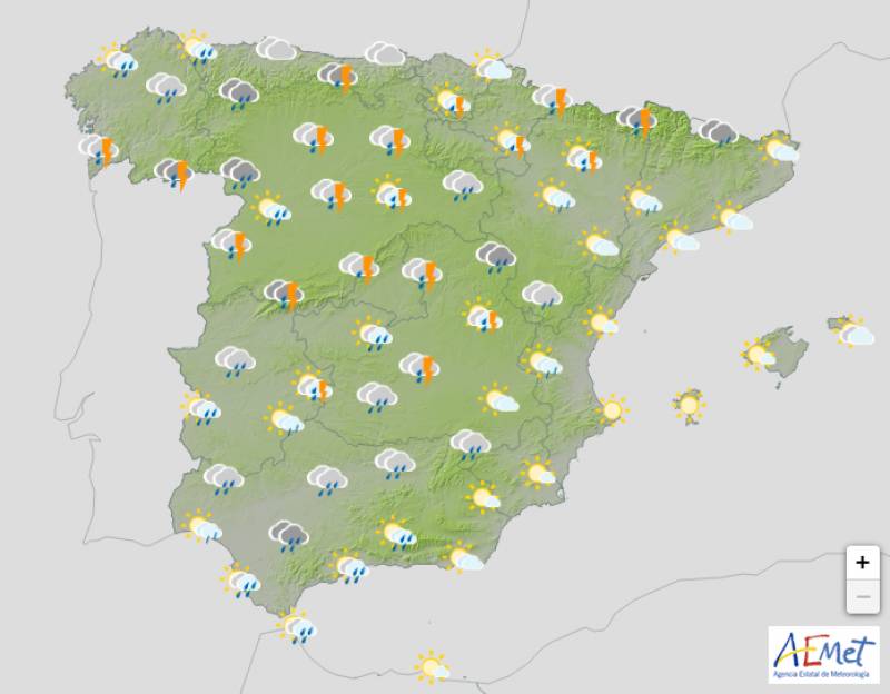
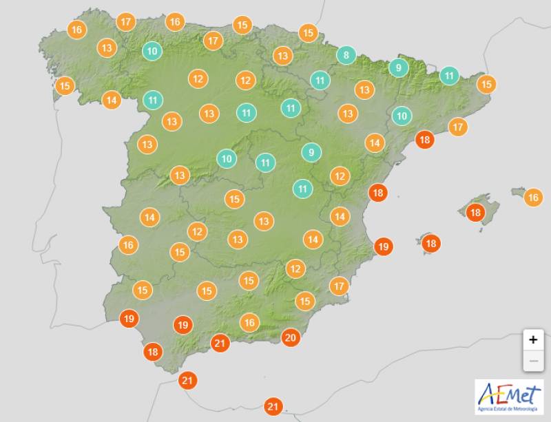
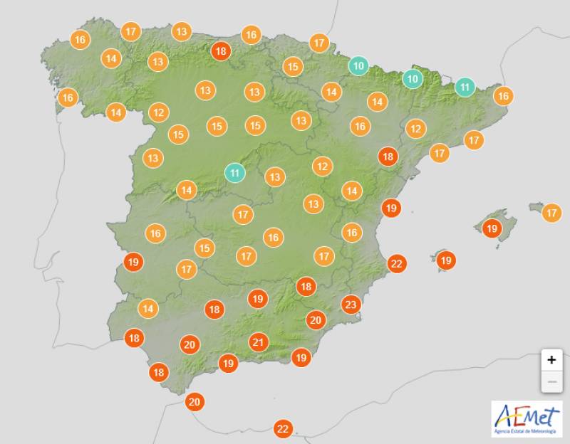
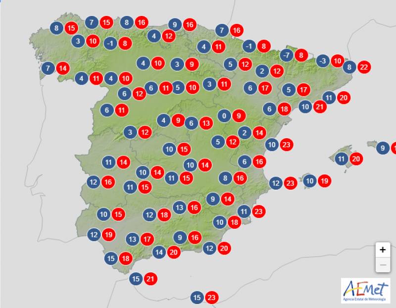
Weather outlook on Wednesday January 17
Most of southern Spain enjoyed a rather unexpected spring-like weekend with temperatures soaring into the mid-20s at the height of the day. In contrast, the north of the country was washed out with driving rain and gusting winds associated with storm Hipólito.
These rains are expected to intensify from the beginning of this week and as both day- and night-time temperatures continue to climb, meteorologists have warned of the chance of flooding as the snow melts in mountainous areas.
"The polar jet is expected to descend to the west of Europe, interacting with the subtropical jet. This will lead to a notable change in temperatures and the appearance of low pressure centres. Everything indicates that these storms will run over the Peninsula from southwest to northeast," explained Víctor González, Meteored expert.
Storm Hipólito will weaken before reaching mainland Spain, but a second and even a third storm sweeping in at the end of the week will bring big changes across the board.
Monday January 15

An Atlantic front with leave behind cloudy or overcast skies in most of the country on Monday with the exception of the Mediterranean, which should stay bright and sunny. The rain will again be heaviest in the north, particularly in Galicia, but these showers could extend further south to the Valencian Community and the western Balearic Islands in the afternoon.
Daytime temperatures will decrease while remaining in the high teens or low 20s, but Monday night will be warmer than previous days practically everywhere.
Tuesday January 16

Weak and scattered rainfall is a possibility in every corner of the country on Tuesday except for the eastern coasts and these showers will turn stormy in western Spain towards the end of the day. It will be mostly cloudy or overcast throughout.
Both daytime and night-time temperatures will increase again in the southeast with few changes elsewhere.
Wednesday January 17

Most of the Mediterranean coast and the Balearics should stay dry on Wednesday but occasional storms are forecast in western Andalucia. Similarly, overcast skies and abundant rain are forecast in much of the rest of the country.
Intense winds will blow from the south and southwest in almost the entire country, with a west wind in the Strait and Alborán, tending to subside in the Canary Islands, and becoming strong on the coasts. Likewise, very strong gusts are expected in large areas of the country and the Balearic Islands.
Daytime temperatures will begin to fall.
Thursday January 18

Spain is expected to continue under the influence of a vast low pressure system on Thursday that will result in mostly cloudy skies and weak showers practically across the board. The rain will be heavier in the northwest and it’s not expected to reach the eastern coasts, although these areas will still be fairly overcast.
Daytime temperatures will still exceed 20ºC in large parts of southern Spain but the mercury will dip again elsewhere.
An intense westerly wind is expected, reaching very strong gusts in coastal and mountain areas of the north and eastern third of the country.
Join our Spain Weather Watch Facebook group for regular updates
Images: Aemet
Loading
Sign up for the Spanish News Today Editors Roundup Weekly Bulletin and get an email with all the week’s news straight to your inbox
Special offer: Subscribe now for 25% off (36.95 euros for 48 Bulletins)
OR
you can sign up to our FREE weekly roundup!
Read some of our recent bulletins:
Discount Special Offer subscription:
36.95€ for 48 Editor’s Weekly News Roundup bulletins!
Please CLICK THE BUTTON to subscribe.
(List price 3 months 12 Bulletins)
Read more stories from around Spain:
Contact Spanish News Today: Editorial 966 260 896 /
Office 968 018 268


