article_detail
Date Published: 27/02/2023
ARCHIVED - Intense cold and snowstorms hit Spain this week: weather forecast Feb 27-Mar 2
An arctic air mass will likely bring “the coldest days in the entire year” to Spain this week

After just enduring the coldest February weekend in years when many towns and cities across Spain saw the thermometers plummet to an icy -10ºC, it seems the worst may yet be to come. The last couple of days of the month will be marked by extremely cold and generally unstable weather across the country thanks to a combination of a DANA (isolated depression at high levels) and a new mass of arctic air, according to the State Meteorological Agency (Aemet).
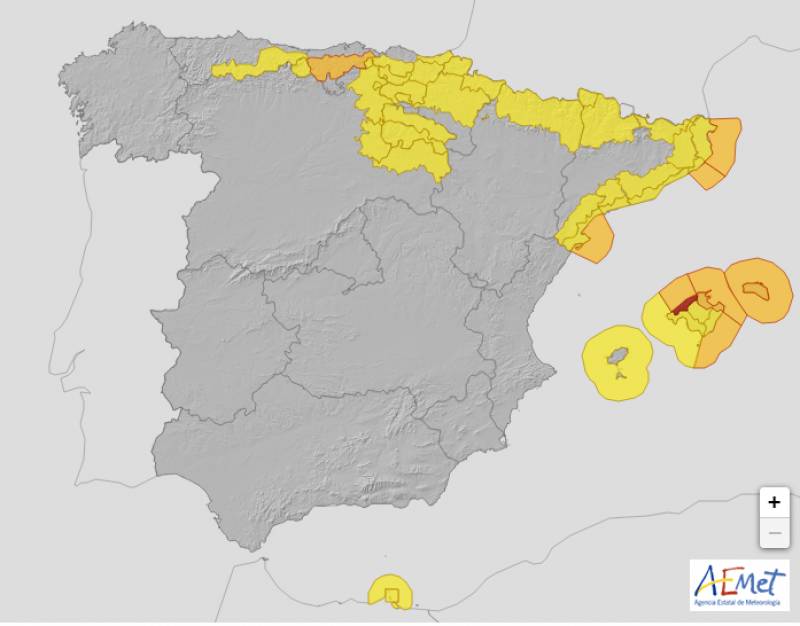
The Balearic Islands will bear the brunt on Monday February 27 and the highest weather warning, a red alert, has been issued for snowstorms, on top of the low temperatures, heavy rain and frost that is also forecast.
On the mainland, the icy weather is expected to be “stronger and more extensive in the northeast”, with night-time temperatures likely to drop to an incredible -20°C at high levels of the Pyrenees and -15 °C in the valleys, according to the Meteored forecast .
"The last days of February could be the coldest days in the entire year," they have predicted.
Winds from the north and northwest, more intense in the north and the Balearic Islands, will make Monday feel even colder and the day will be generally overcast or mostly cloudy throughout.
After enjoying temperatures in the high teens on Sunday, the mercury will drop to just 13°C in Alicante and 12°C in Murcia.
There’s little improvement on Tuesday February 28 when the snow level will fall to between 100 and 200 metres. Moreover, Aemet predicts that “the level could occasionally drop to sea level on the Peninsula”, meaning that it could even snow along the coast.
Locally strong and persistent rainfall is forecast in the northeast and the Balearic Islands remains under a red alert for snowstorms, the threat of which should pass by mid-morning.
It will be another breezy day with the chance of scattered showers throughout, although the temperatures will recover slightly in the east of the country.
As we leave February behind, the polar air mass “will begin to withdraw” on Wednesday March 1 and daytime temperatures will begin to creep up again, reaching highs of 17°C in parts of Andalucia.
However, the weak winds will cause the frosts to remain strong in areas of the Pyrenees and the Cantabrian mountain ranges.
And while the red weather alerts have been shelved for now, several regions are in for an extremely cold day and night.
The weather forecast becomes a little more uncertain from Thursday March 2, although Aemet believes "it is most likely that the thermal rise will consolidate in the following days."
Cloudy intervals are predicted in most of the country with weak rainfall in the north that could also hit the Mediterranean coast later in the day.
Daytime temperatures should continue to rise except on the islands and in the extreme south, where few changes are expected. The night will also be a lot cooler in southern areas, with the mercury falling to just 2°C in Murcia.
Join our Spain Weather Watch Facebook group for regular weather updates
Image: Aemet
Loading
Sign up for the Spanish News Today Editors Roundup Weekly Bulletin and get an email with all the week’s news straight to your inbox
Special offer: Subscribe now for 25% off (36.95 euros for 48 Bulletins)
OR
you can sign up to our FREE weekly roundup!
Read some of our recent bulletins:
Discount Special Offer subscription:
36.95€ for 48 Editor’s Weekly News Roundup bulletins!
Please CLICK THE BUTTON to subscribe.
(List price 3 months 12 Bulletins)
Read more stories from around Spain:
Contact Spanish News Today: Editorial 966 260 896 /
Office 968 018 268


